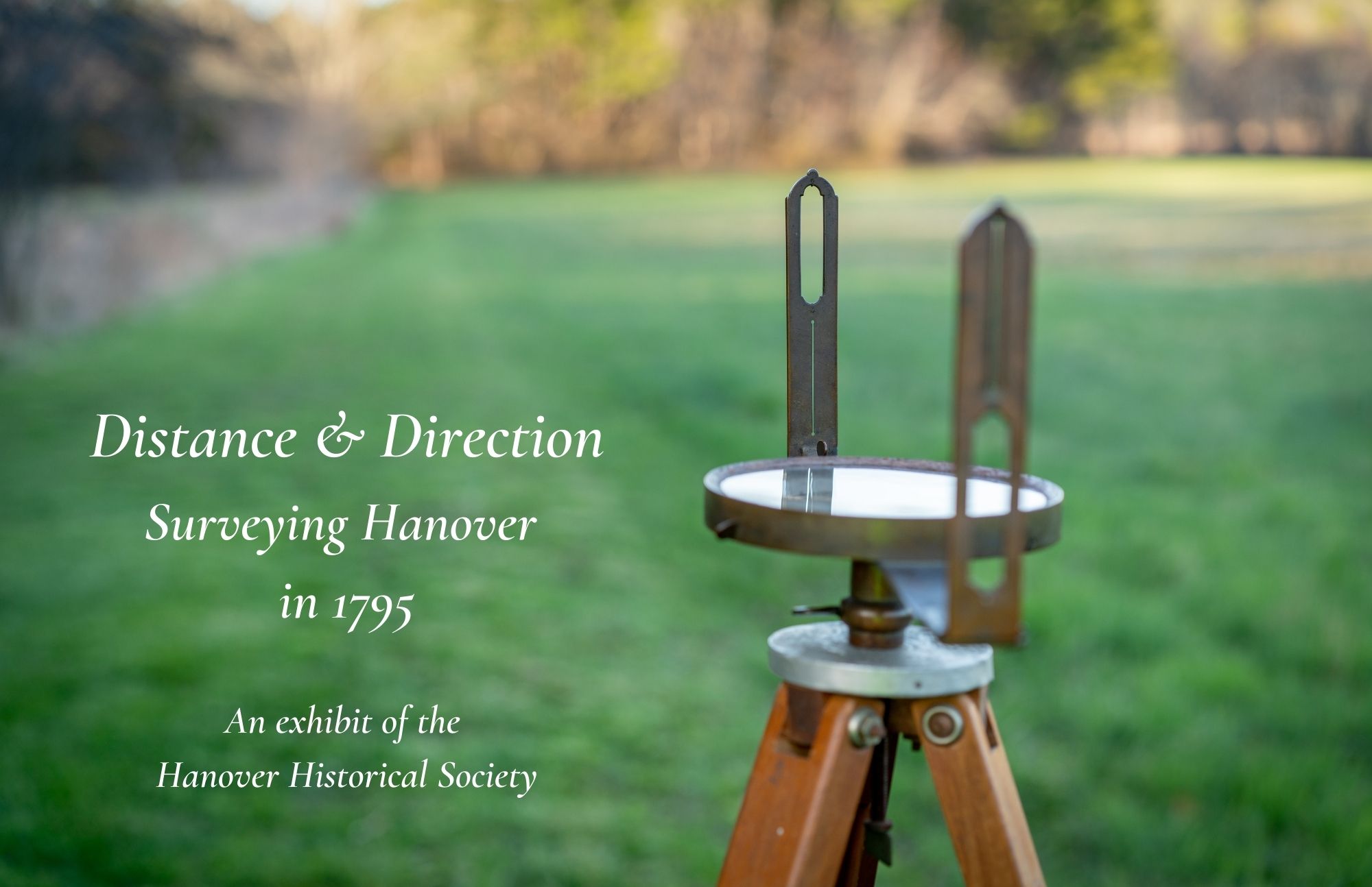
Surveying the Commonwealth
The May Session, 1794, of the Massachusetts General Court approved Chapter 101, which read: “Whereas an accurate Map of this Commonwealth will tend to facilitate & promote such information and improvements as will be favourable to its growth and prosperity, and will otherwise be highly useful and important on many public and private occasions,” towns throughout Massachusetts, which included Maine at the time, were require to survey their boundaries. “Resolved, that the Inhabitants of the several Towns and Districts in the Commonwealth…cause to be taken by their Selectmen or some other suitable person or persons appointed for that purpose accurate plans of their respective Towns or Districts, upon a scale of two hundred rods to an Inch.” Copies of the survey were “to lodge in the Secretary's Office, free of expence to the Commonwealth, on or before the first day of June in the year 1795.” These town surveys are located in the Massachusetts State Archives.
John Bailey Biography
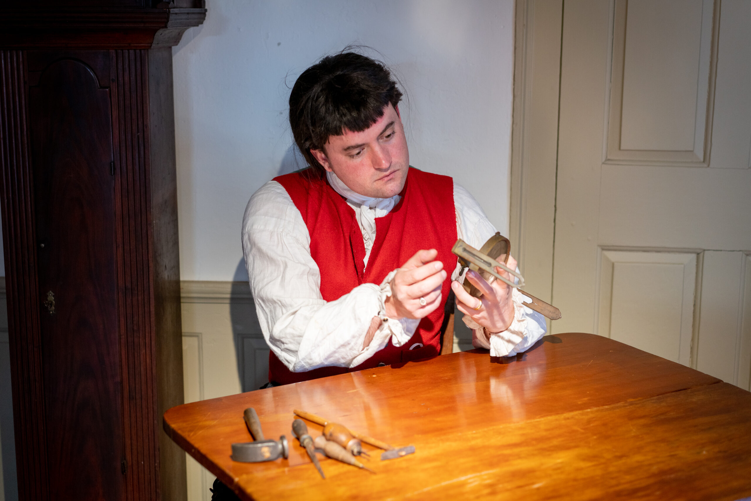
John Bailey II (1751-1823) was a successful clockmaker, engraver, and inventor. He was born in Hanover, the son of John Bailey I (1730-1810) and Ruth Randall Bailey (1731-1821). John Bailey I was a shipbuilder who served as Hanover selectman and was colonel of the 2nd Massachusetts Regiment during the Revolutionary War, participating in the Siege of Boston (1775-1776), and the battles of Trenton (1776) and Saratoga (1777), before returning home in 1780. John Bailey II was married three times, first to Ruth Ellis (died 1792), second to Mary Hill Bailey (1752-1792) of Lynn, and third to Tabitha Olney Bailey (1751-1827) of Providence, RI, and was the father of five children. Bailey’s workshop in Hanover employed his two brothers Calvin and Lebbeus, his two sons John III and Joseph, and assistants Joshua Wilder, Joseph Gooding, and Ezra Kelley, producing dozens of clocks, including one in the collection of the Hanover Historical Society. Bailey was an active member of the Society of Friends, the Quakers, and was buried in the graveyard at the Friends Meetinghouse in North Pembroke.
Handmade & Custom Crafted
Clocks and other devices made by John Bailey in his Hanover workshop were often a combination of pre-made or partially-made pieces, custom built elements, and even imported decorative pieces purchased from merchants in Boston. Bailey and his assistants had versatile skills to assemble the brass movements, gears, and dials of clock’s inner workings, house the works inside a fine wood cabinet, and add the decorative elements of painted faces, engraved plates, and metal fittings. It was a process that involved many craftsmen to create clocks of different sizes and range of decoration. Sometimes just the clock works were sold to cabinet makers that fashioned their own casings. Bailey himself was at the center of a busy production line, engraving his name onto many of his workshop’s finished pieces.
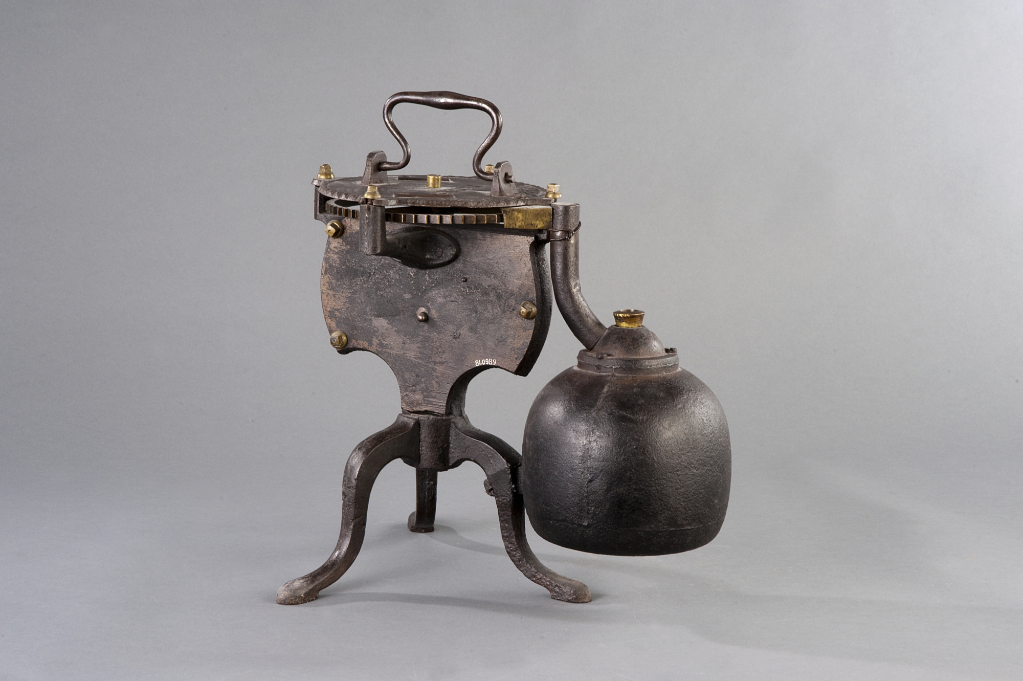
Measurements overall: 14 1/2 in x 15 3/4 in x 10 1/2 in; 36.83 cm x 40.005 cm x 26.67 cm
Accession number 1981.0989, Gift of Dr. John P. Remensnyder, Doris R. Ballantyne, Boston, MA, National Museum of American History, Smithsonian Institution, Washington, DC.
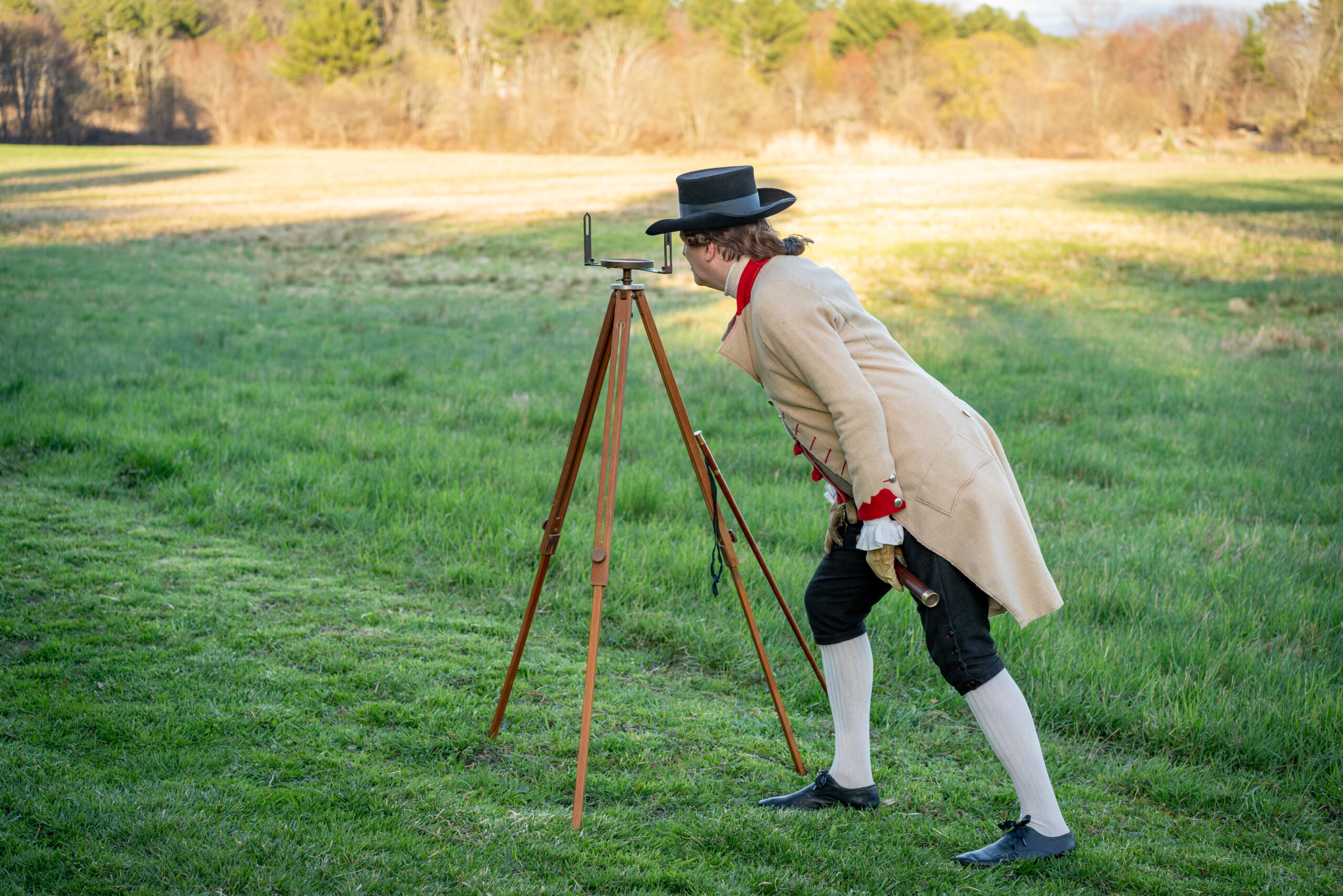
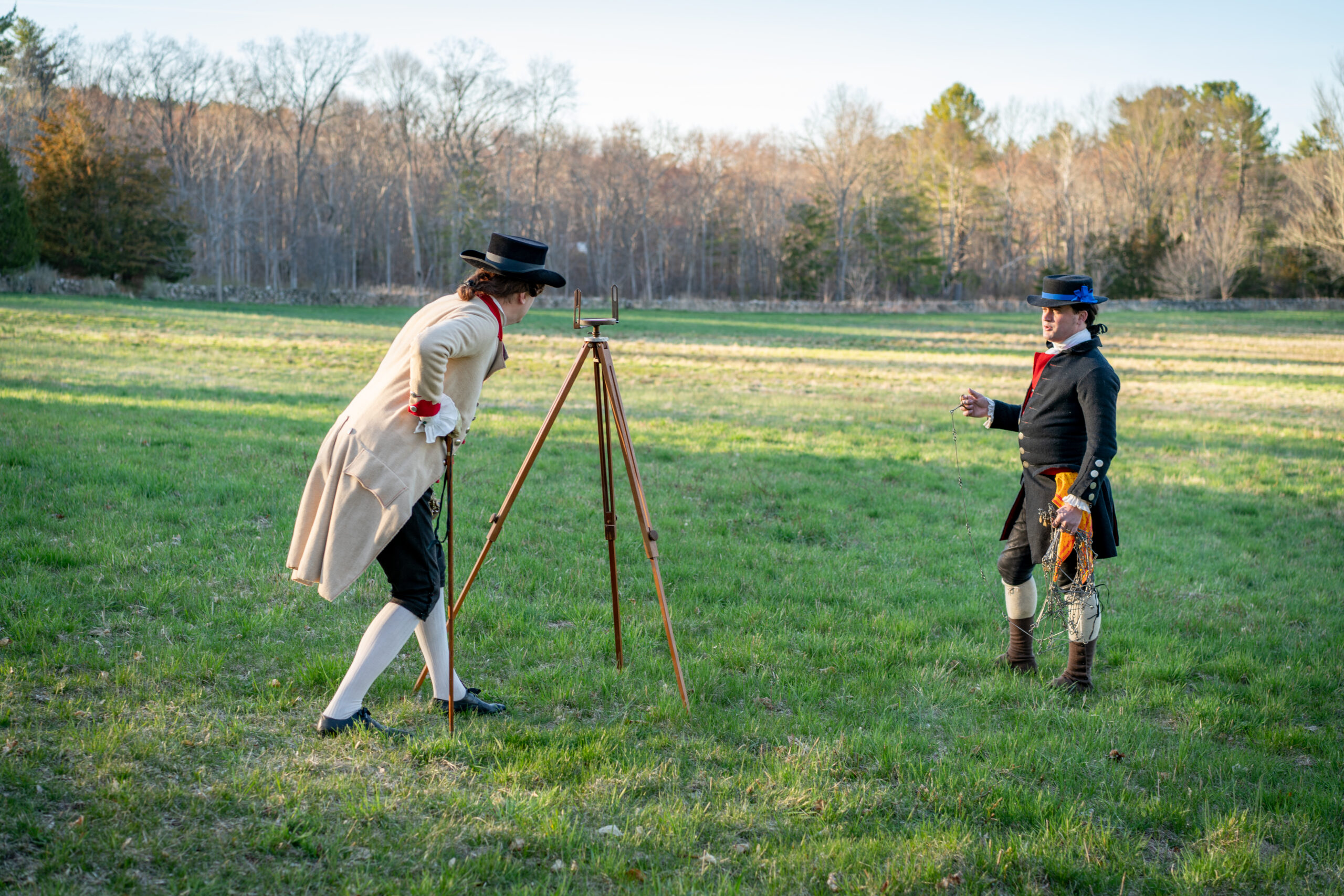
The Surveyor’s Compass
A surveyor’s compass was used for determining direction when measuring out distances on land. The compass was positioned on a wooden tripod, the surveyor then looked through the sights on either end, and would then site a point of land to determine a horizontal angle.
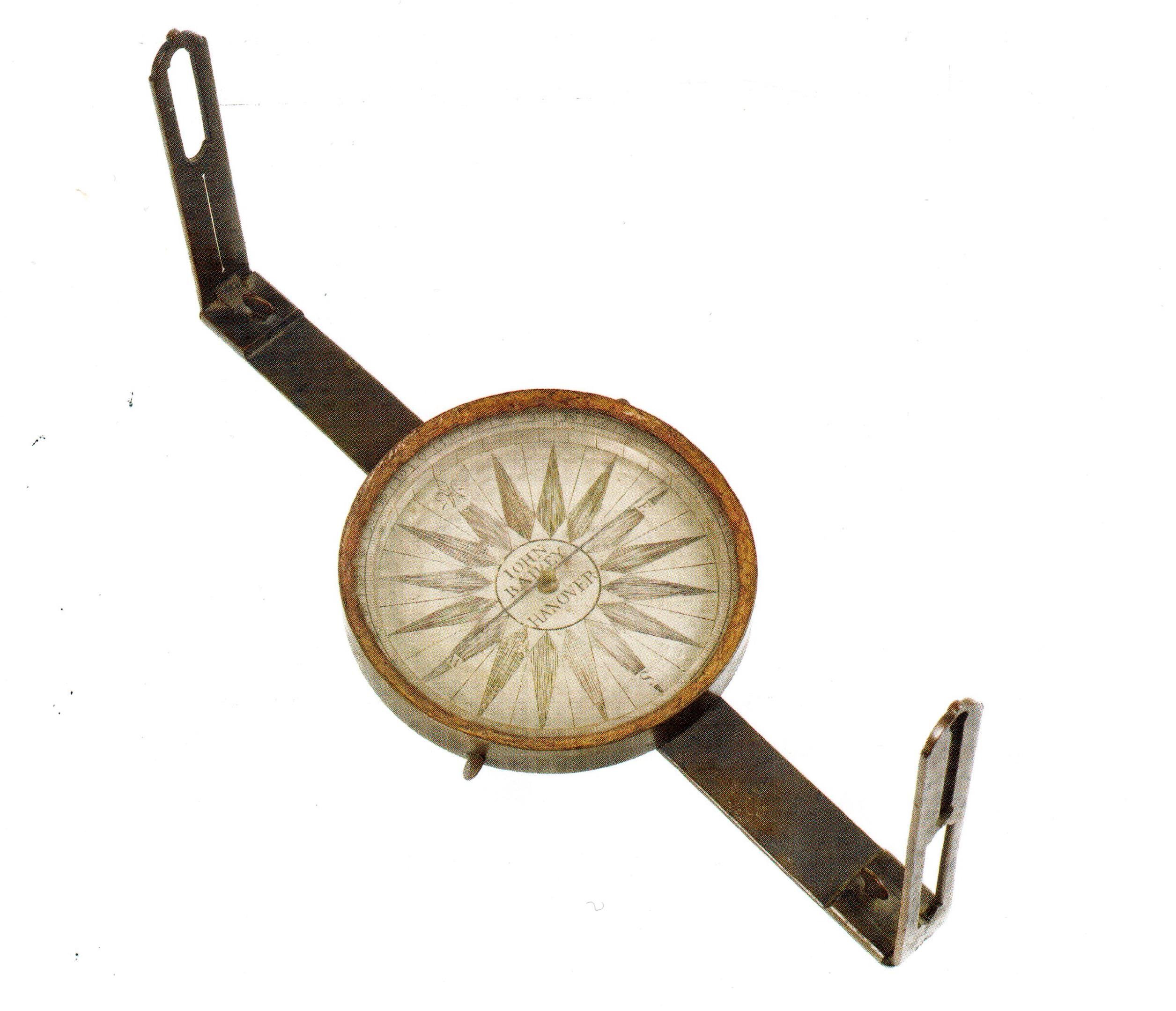
Similar compasses were used by the teenaged George Washington to survey the Blue Ridge Mountains and other parts of Virginia in the late 1740s and early 1750s, by Charles Mason and Jeremiah Dixon in measuring out the famous Mason & Dixon Line settling the boundary lines between Pennsylvania, Maryland, and Delaware in 1763 to 1767, and by Lewis and Clark on their exploration of the Louisiana Purchase and Oregon Territory in 1804 to 1806.
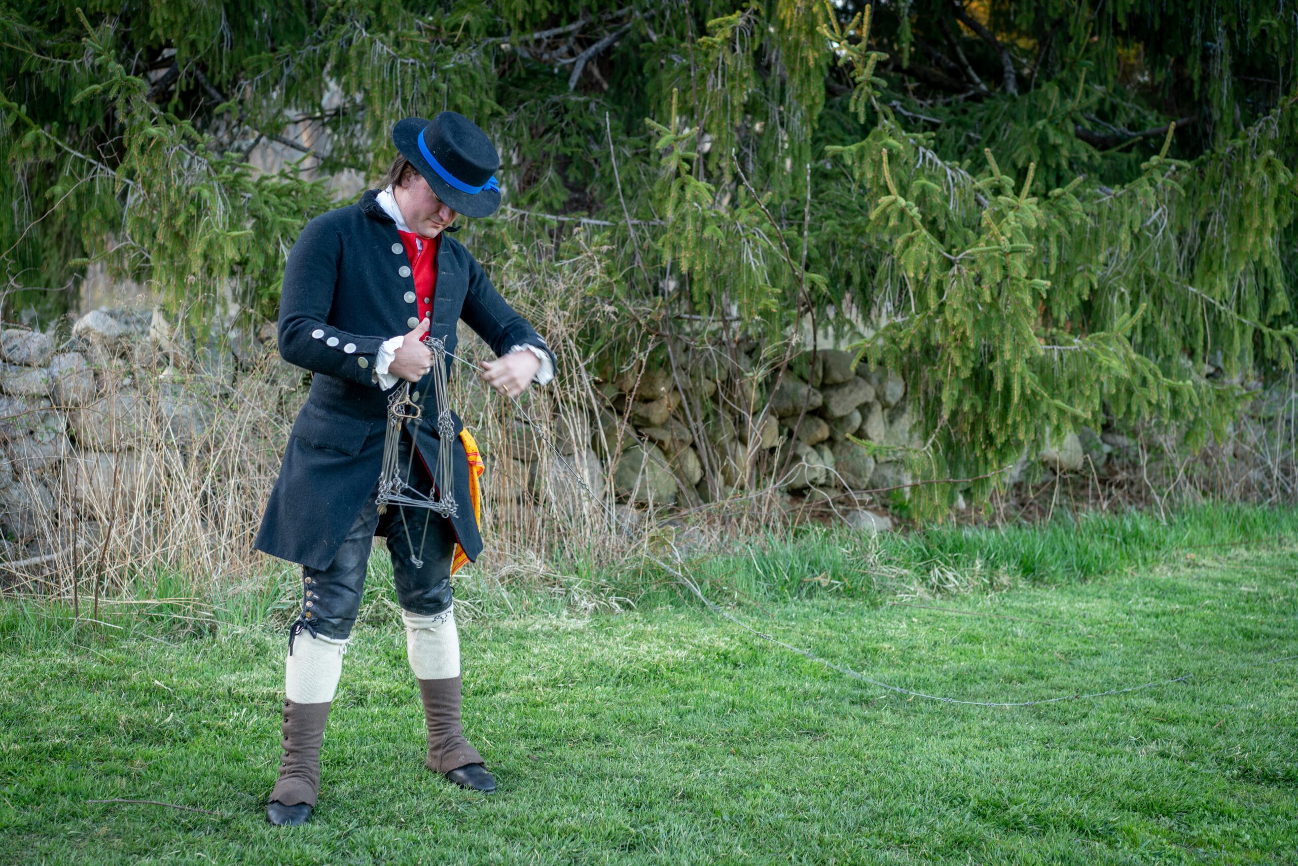
Rods, Links, & Chains
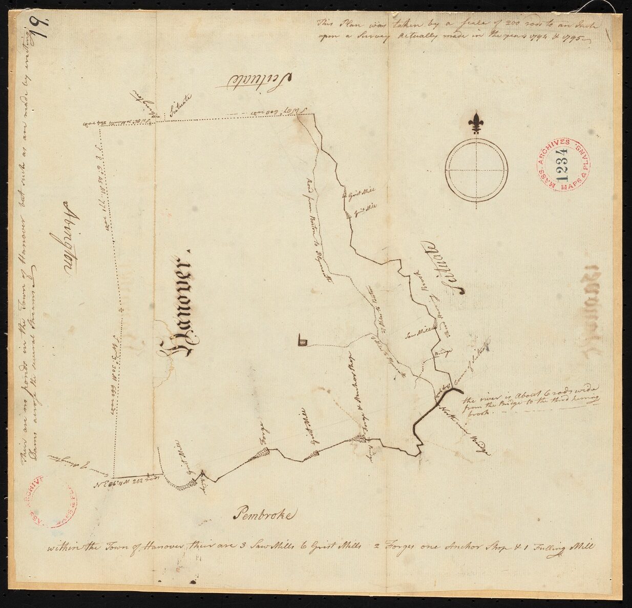
A measuring “chain,” called a Gunter’s Chain and developed in the early 17th Century, was used by surveyors for measuring out a specific distance. A chain was made of 100 metal links, each 7.92 inches long. One chain equaled four rods, which equaled sixty-six feet or twenty-two yards. One mile equaled 80 chains (5,280 feet) and one acre equaled ten square chains. Using these types of measurements, surveyors plotted out properties and towns throughout the New Republic. These measurements were officially adopted in the Land Ordinance of 1785. These measurements appear on the 1794-95 map of Hanover surveyed at “a scale of 200 rods to an inch.”
The Survey Map of Hanover
The original survey map of Hanover was created in late 1794 and early 1795. The surveyors noted the bordering towns of Scituate to the North and East, Abington to the West, and Pembroke to the South. The Third Herring Brook and the North River mark the Eastern and most of the Southern boundary. The words at the bottom read “within the town of Hanover there are 3 saw mills 6 grist mills 2 forges one anchor shop & 1 fulling mill.” Other descriptions on the map include “The [North] River is about 6 rods [99 feet] wide from the bridge to the Third Herring Brook.” The few other details on the map include the main North-South road, stating “27 miles to Boston / 15 miles to Plymouth,” the cross road at Four Corners, and the road to the meetinghouse in the center of town.